Across much of Britain historic patterns of ploughing are preserved in fields now used for pasture. In some cases these ‘ridge-and-furrow’, or ‘rigg’ in the north of England and Scotland, can be hundreds of years old. The process of repeated ploughing using ploughs with ‘mould boards’ built up ridges of a foot or more, especially in areas with heavy soil.
Ridge-and-furrow can be correlated with the strips of large open-fields shown on sixteenth century maps in terms of length, breadth, and position.[1] The number and extent of the fields varied, and strips were of differing length, breadth, and area according to the nature of the soil and lay of the land. Strips of half or a third of an acre were probably most usual. They were individually owned but initially farmed in common amongst the parish, in line with regulations agreed at the manor court and with communal grazing permitted after the harvest.
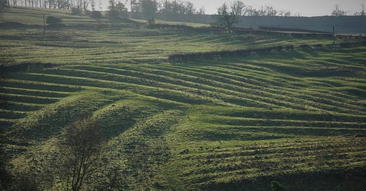
Philip Halling, Medieval Ridge and Furrow above Wood Stanway (CC BY-SA 2.0)
Ridge-and-furrow patterns in former open-fields curve like an inverted ‘S’ as the team of ploughing oxen turned before they reached the bank or headland which would grow up at the end of the rows. Furrows marked strip boundaries, were useful for drainage and added to the overall surface area of the field. Strips were separated from their neighbours by a double furrow, or in some regions, an unploughed grass balk. The patterns follow the lie of the land and separate furlongs go in different directions. A furlong was originally the length of a furrow in an open-field but the term came to be used for a block of strips. Furlongs were also known as shots or shutts, and in the north of England a flatt. A field would have been made up of scores of furlongs and hundreds of strips.
The open-field system was imposed across England but abandoned at different periods, with the coming of enclosure. In some peripheral regions such as the south-east, south-west and north-west the system had disappeared with the Tudor enclosures of the sixteenth century. The hawthorn hedges of Parliamentary enclosure often ignored these older farming patterns, however enclosure by agreement created hedges or walls which could preserve them.
The arable strips of the open fields were fossilized, so to speak, under grass when the extensive sheep and cattle pastures were created between the fifteenth and seventeenth centuries.[2]
It should be noted that not all ridge-and-furrow is centuries old. Land taken from the commons and wastes by Parliamentary enclosure, especially around 1800, was freshly ploughed with straight, narrow ridge-and-furrow. Newer patterns like this are, for example, found on the edges of the Pennines.
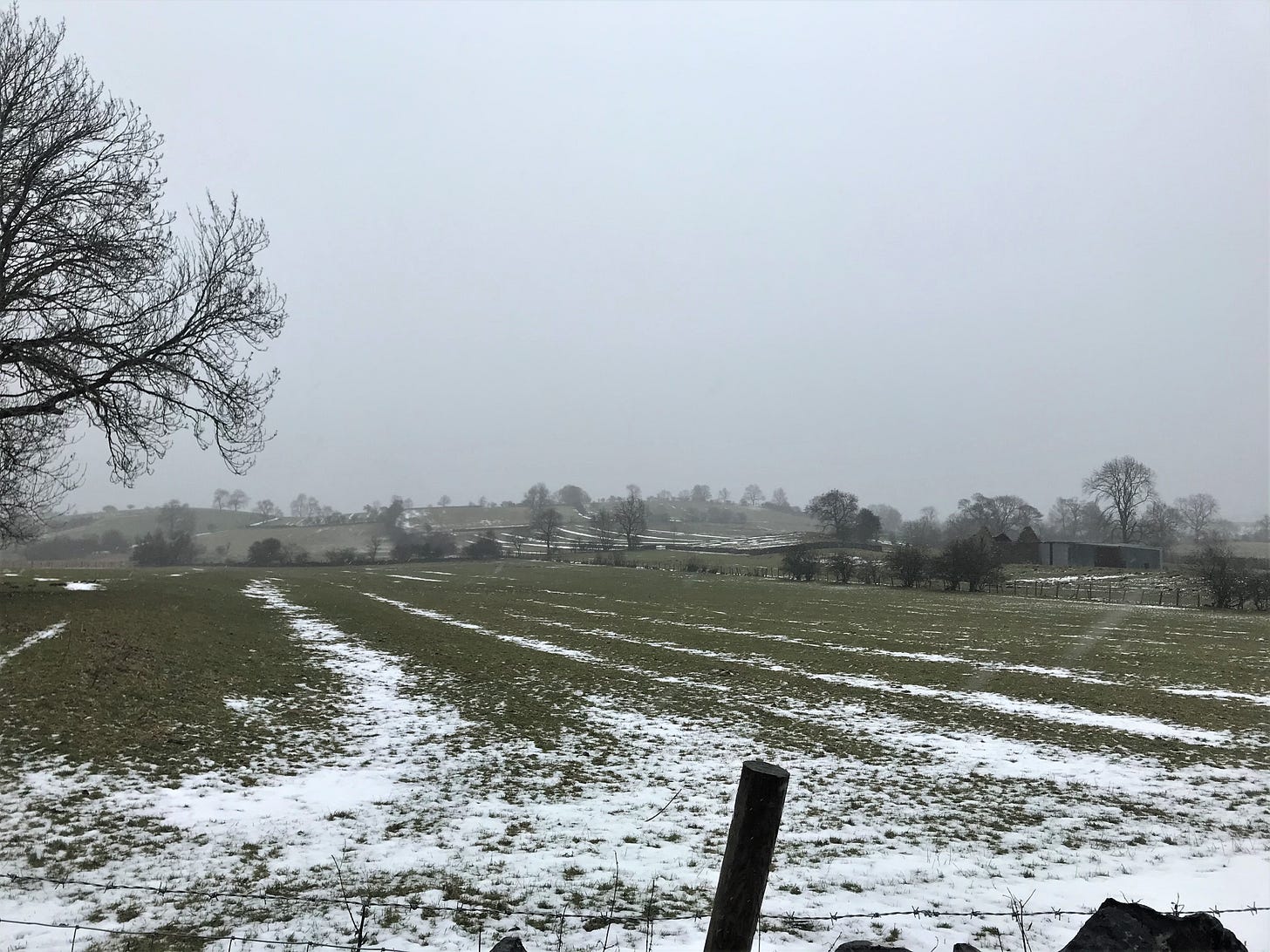
Joe Saunders, Ridge-and-furrow Crosby Garrett, Eden Valley
Surviving examples of ridge-and-furrow can be found across Britain though in many areas they are only soil marks or slight earthworks. Furrows often appear greener than ridges and in season can be marked by buttercups or surface water. They are particularly noticeable in the Midland Plain which today has some of the best arable land in England. Ridge-and-furrow is rarer in wood-pasture regions which only ever had small open fields and in chalklands where they have been more easily lost to weathering or ploughed-out. A great deal of ridge-and-furrow has been destroyed over the last century by deep ploughing, especially during the intensive farming of the Second World War. They can, however, be seen in modern and twentieth-century aerial photographs. From the ground they are seen best in low winter sunlight.
References and Resources:
Information for this post was taken from the excellent David Hey (ed.), The Oxford Companion to Local and Family History (1996), 331, 395, 426-7 and W.G. Hoskins, The Making of the English Landscape (1985), 45-50.
Historic England’s online Introductions to Heritage Assets has an excellent edition on Field Systems
There are over 400,000 digitised photos taken from Historic England’s aerial photo collections: Aerial Photo Explorer
The Cambridge University Collection of Aerial Photography (CUCAP) is the result of airborne survey campaigns which were started in 1947 by the pioneering JK St Joseph and has grown to almost 500,000 images.
George C. Homans, English Villagers of the Thirteenth Century (1991)
Alan Wilkinson, ‘Interpreting aerial photographs of farmland and village’ The Local Historian, 15:7. (1983), 402-5.
James C. Jackson, ‘The ridge and furrow controversy’ The Amateur Historian, 5:1. (1961), 23-8.
[1] M.W. Beresford and J.K. St Joseph, Medieval England: An Aerial Survey (1979).
[2] W.G. Hoskins, The Making of the English Landscape (1985), 48.


This s very interesting. I’m glad you included pictures. Otherwise I would not have understood the description.