Most of England’s parishes had been established by 1200. Throughout subsequent history they have been instrumental in shaping English life. While the origins of parish boundaries have historically been open to debate, many parishes reflect the outline of pre-Conquest estates. The shape and size of parishes varies from one area of the country to another. The layout of parishes in urban areas differs from those in the countryside. London had over a hundred parishes by the end of the medieval period while leading regional centres such as Norwich or York had over forty each. New industrial towns like Manchester and Sheffield grew so rapidly that they were served just by single parishes which also included larger sections of the countryside. These huge urban parishes were not divided into new ones until the middle of the nineteenth century.
Derek Harper, Parish boundary marker, Bristol (CC BY-SA 2.0)
Sixteenth century government gave responsibility for the poor, the highways, and for petty law and order to civil parishes, which often covered the same area as the ecclesiastical parishes. Where ecclesiastical parishes were large, their subdivisions (townships or groups of townships) became the civil parishes. Information of the size and shape of these civil parishes can be obtained from nineteenth-century directories, the large-scale maps of the Ordnance Survey, and the relevant volumes of the Victoria County History. The Local Government Act of 1894 divided England and Wales into around 14,000 parishes and the boundaries generally followed those of the old civil parishes. Anomalies caused by divided parishes and detached portions were removed.
It was within a parish that daily life was conducted. The social and economic lives of ordinary people were played out here, especially in the medieval and early modern periods. People mostly worked and largely married people within their parish. While people did move during the course of their lives, and often permanently, in many parishes families continued over generations. A sense of parish identity was reinforced by regular ‘beating of the bounds’, walking over the boundaries. The parish was the site of social activities, especially in the spiritual and cultural heart, the church and churchyard. Church was attended by almost all at least once a week. Business was conducted in the churchyard before and after services. The churchyard was also the site of community events such as the Church Ale, an occasional opportunity to get together with neighbours to have a drink and support the church. Parochial pride was expressed in the pitting of one parish against another in sports such as the game of Camping in eastern England, akin to modern football. There were also ongoing efforts to maintain, repair and improve the church buildings which were the physical manifestation of the parish.
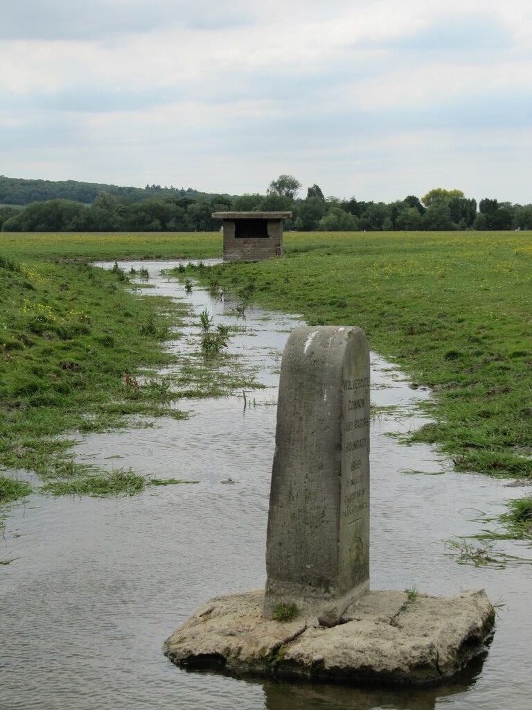
David Tyers, Wolvercote parish boundary marker stone (CC BY-SA 2.0)
For the historian the parish is an important way to approach research. When looking at an individual it is important to understand the context of their parish. When researching themes the parish often presents a logical focal point while local historians regularly make the parish the subject of our investigations. In a practical sense too the parish has historically been a key unit of administration which has created numerous parish-based documents for the researcher. Many of these were once held in the Parish Chest, a large storage unit usually kept in the church itself but which were deposited in record offices over the course of the twentieth century. This includes, for example, parish registers of baptisms, marriages and burials, beloved of family historians and demographers. The list is extensive though from Churchwardens’ and Vestry accounts through to records of tithes. Beyond sources from the Parish Chest many historical records use the parish as the core unit such as the Census and Hearth Tax.
The Scottish historian should be aware that Scotland had acquired a structure of ecclesiastical and civil parishes similar to England by the sixteenth century. In Ireland, medieval parishes were often made redundant by the land reallocations of the seventeenth century. The parishes of the Church of Ireland are usually amalgamations of ancient parishes but the Catholic Church had to create a new parish network in the eighteenth and nineteenth centuries.
A final note that The Cambridge Group for the History of Population and Social Structure (CAMPOP) are seeking volunteers to help create and make freely available a digital map of the boundaries and names of the ancient parishes of England.
References and Resources:
Information for this post was taken from the excellent David Hey (ed.), The Oxford Companion to Local and Family History (1996), 375.
My-Parish. A virtual platform which supports a range of initiatives on parish history, art, heritage and culture.
W.E. Tate, The Parish Chest: A Study of the Record of Parochial Administration in England (3rd ed. 1969)
Cecil R. Humphery-Smith, The Phillimore Atlas and Index of Parish Registers (3rd ed. 2002)
Angus Winchester, Discovering Parish Boundaries (2000)
Katherine L. French, The Parish in English Life, 1400-1640 (1997)
N. J. G. Pounds, A History of the English Parish: The Culture of Religion from Augustine to Victoria (2008)
T.C.H. Cockin, The Parish Atlas of England (2017)


